Dr Kathleen Kozyniak
Principal Scientist Air
Hawke’s Bay Regional Council
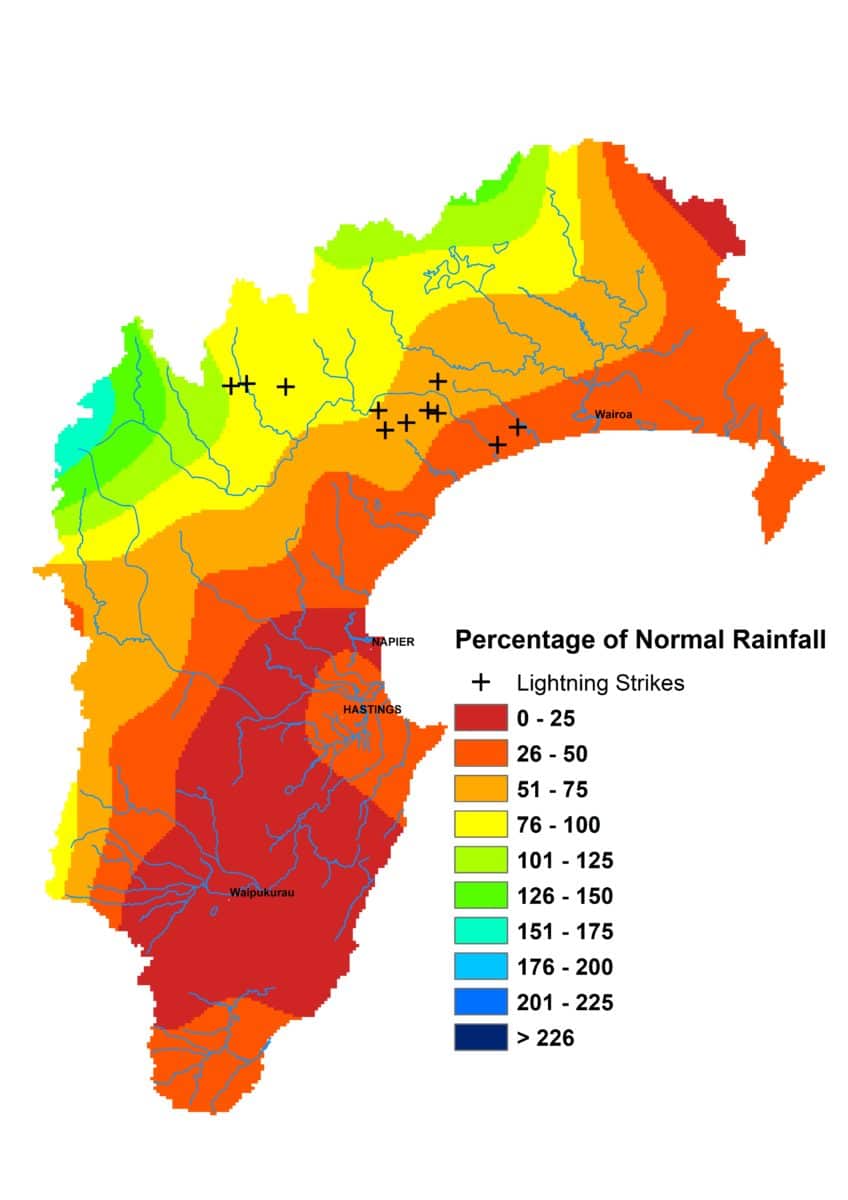
With July rainfall having been so low, it was blow that a reasonably dry August followed. The region got 75% of normal August rainfall, which wasn’t flash, but things looked particularly bleak on the Heretaunga Plains, with only 59% on the back of 21% for July.
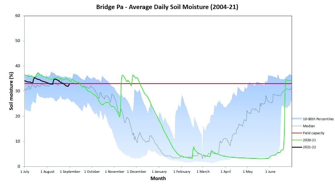
River flows were low across the region during the month and low flow bans were beating numbers at the same time last year. August saw an increase in the number of groundwater sites falling into the red. Soil moisture mostly held steady near or just a little below median levels for the time of year and appeared to be the main beneficiary of the rain we did get. But there were some areas, such as the hill country west of the Heretaunga Plains, that were concerningly dry heading into spring.
August temperatures were contrary. Daytime temperatures were over half a degree above average and overnight temperatures were below average by the same margin. Soil temperatures ended the month about average on 11°C. We had a good winter for air quality so a heartfelt thanks to those who sought alternatives to burning vegetation in the open or did so with great care.
The spring forecast is a tussle between different climate influences. On the one hand we have a La Niña event threatening to develop and a negative Indian Ocean Dipole event currently happening. They are usually, though not always, positive for rain. But the seasonal forecast models predict higher than normal pressure across our region and accompany that with a prediction of below normal or normal rainfall, variable winds and warm temperatures to boot. At the time of writing, we’ve just had some very welcome mid-September rain, which sees us closing in on the month’s average rainfall. That’s a great start but it’s worth remaining wary that one month doesn’t make a spring and summer.
Percentage of Normal Rainfall