Technology is developing at a rapid rate, especially in our horticultural industry. Over the last year I have been researching, testing and developing tools that will help growers farm with precision in an affordable way.
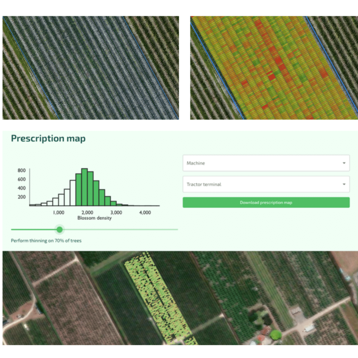
You would’ve seen a number of maps like these below, whether it be blossom density, canopy density, tree height or fruit number, all of which give you data at a tree level allowing you to get accurate representation of a block. Different growers have different appetite for the level of granularity they will manage to. Some like to identify the problem areas, some use the data to representatively position scouting trees and some use variable rate sprayer technology to apply chemical thinners and/or PGR’s to only the trees that need it.
Below is a 7th leaf vigorous block of Envy(TM), one that is ready for its first year of growth suppressant. However, not every tree needs it. With ground truthing using geolocated maps you can identify at what level to turn the sprayer off, download the prescription map like the one below, plug it into the sprayer and you’re away. Using the example below, you’d be reducing your chemical output by 30% and reducing the variability within the block.
Growers also use these maps to quantify the proportion of each vigour category across a block to calculate a better yield estimate, direct fruit counters, leaf samplers and consultant visits.
With data comes opportunity and often the opportunity to farm more accurately. It’s a question of how you use the data to fit with your business and your processes. We are coming into the vigour mapping season so if you’re wanting to start in the precision line of management, give me a call.

Jack Wilson
Agfirst Consultants (HB) Ltd


