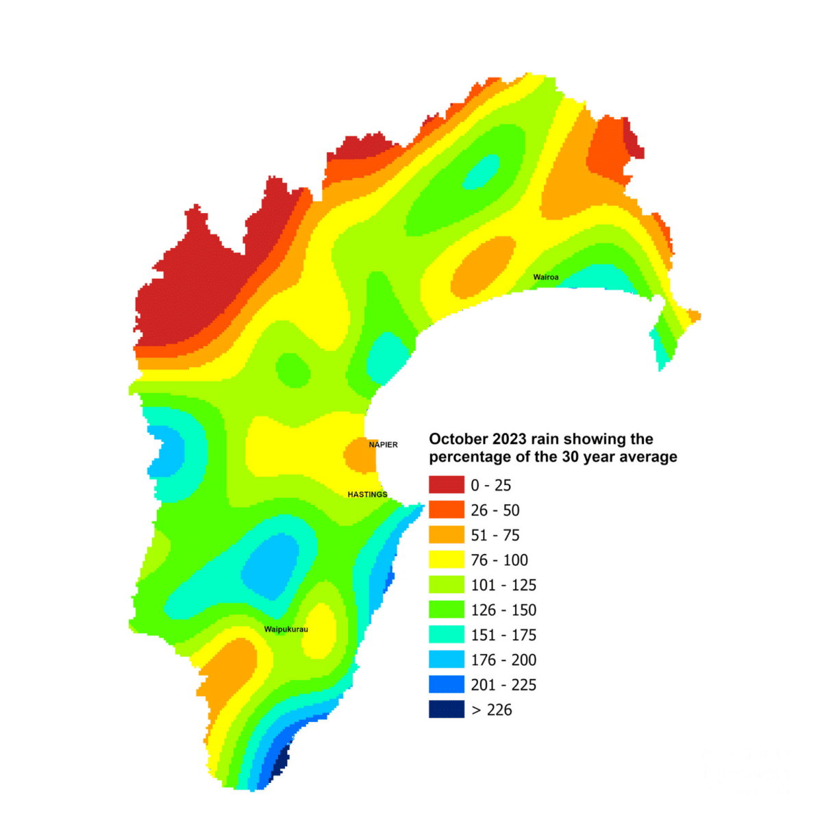
Once again, like September, rainfall late in the month meant October’s totals for the region fell in the near normal range. However, the Ruahine Range, Ruataniwha Plains and the southern coast were the outliers and recorded above normal rainfall. Other measures of our water stocks covered the range of possibilities – soil moisture levels were higher than normal for the month, groundwater levels were near normal and river flows were below normal due to the soils still absorbing the bulk of the rain.
Soil temperatures were warm for mid-spring, helped along by warmer than average sea temperatures, which also stoked daytime air temperatures to almost 1°C above average. Overnight temperatures were fairly typical for October and only one frost was recorded at our Bridge Pa site on the very first day of the month.
El Niño conditions are with us and are destined to influence our weather throughout summer. We also have a positive Indian Ocean Dipole currently underway. The predominant wind flow across the next three months is expected to be westerly, driven by higher than normal sea surface pressure over and north of the country and lower pressure to the south. That would all point to drier and warmer conditions than usual, which is what most of the seasonal forecast models suggest. But the odd burst of rain, aided by the warm seas around us, is likely to push us into the near normal range for November at least.
Percentage of Normal Rainfall
Dr Kathleen Kozyniak
Principal Scientist Air
Hawke’s Bay Regional Council


