
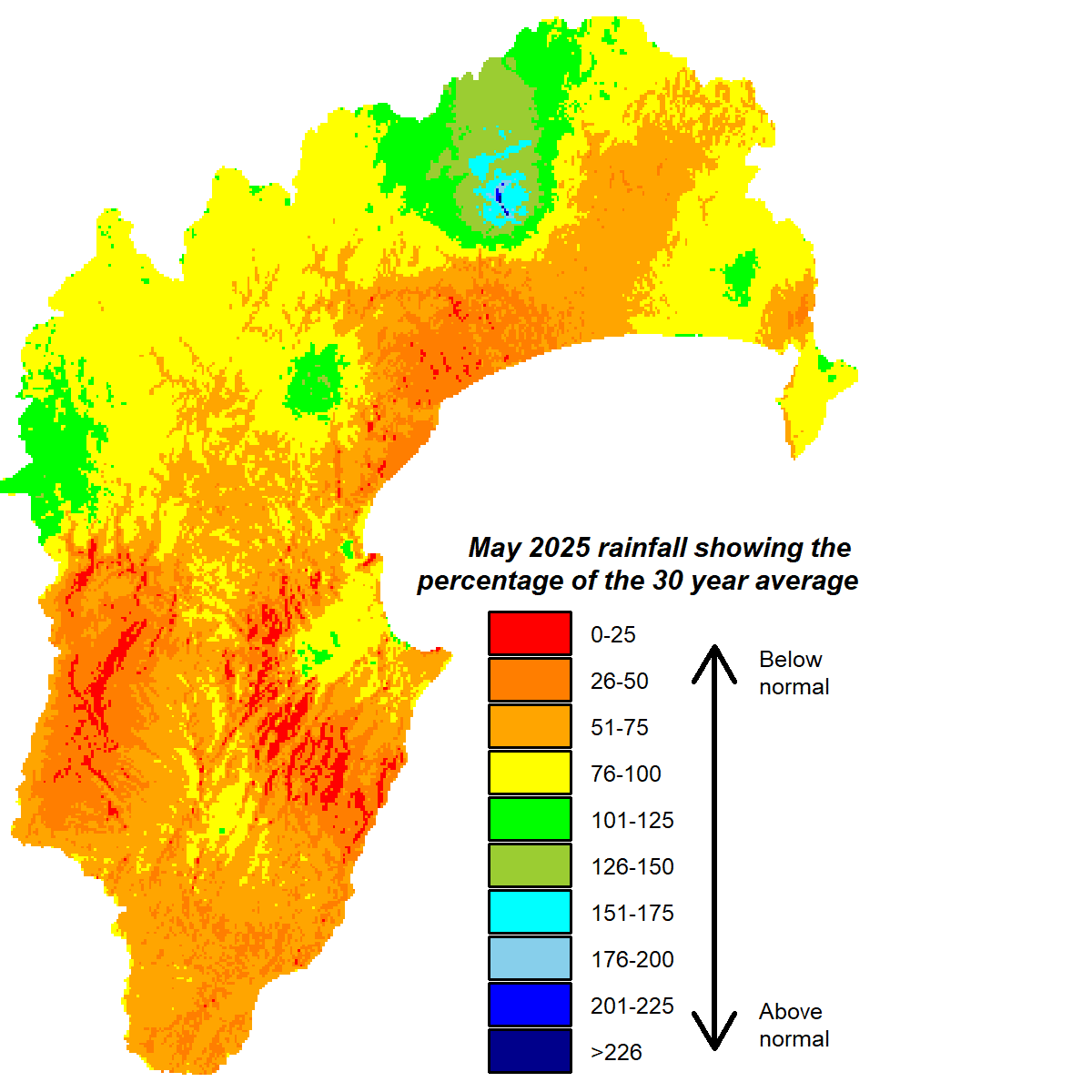
May was a mild and slightly dry end to autumn. It delivered below normal rainfall to the region although some northern areas, such as Waikaremoana and Tangoio, came within the normal range for the month and likewise the Kaweka Range. The rest of the region captured 70% or less of average May rainfall.
The headwaters of many of our rivers had enough rain to keep flows near normal for the month and groundwater stocks were looking good at near normal levels too. Soil moisture is at field capacity or at least near or above median levels for the start of winter, apart from the Heretaunga Plains and Porangahau where soil moisture is low. Daytime temperatures were pleasantly 1°C above average during May and overnight temperatures were 0.5°C above.
The forecast for winter suggests seasonally mild temperatures could continue, supported by warmer than average seas around New Zealand. It is also supported by a pressure pattern that favours a northeast wind flow. Lower than normal pressure is expected to the country’s northwest and higher than normal to the east. The El Niño-Southern Oscillation is predicted to sit in neutral gear (neither La Niña or El Niño) for winter and could even stay that way for the remainder of the year. A forecast of near or above normal winter rainfall is therefore based on the favoured northeast wind direction and the warmth of the seas around us and along the Australian coast.
All the best,
Kathleen


