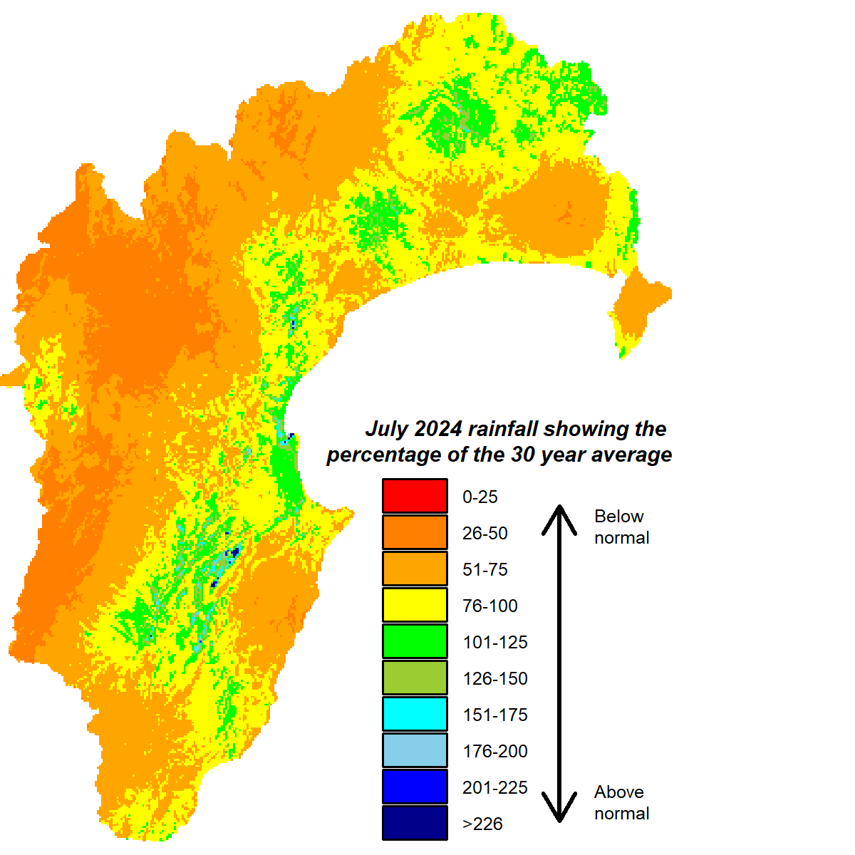
A two-month run of wet weather came to an end in July. Most of the region received below normal July rainfall, apart from the Ruataniwha Plains and Northern Hawke’s Bay where totals fell within the normal range. The western ranges received only half the month’s average, while the Heretaunga Plains fared better with about three quarters.
The shortfall in rain didn’t trouble soil moisture, which remained above median levels for the time year and, for most sites, at or near field capacity. July’s river flows tracked a little below normal but groundwater levels were solidly near or above average. Daytime air temperatures were a balmy 1.5°C above average. Nights were warm too but only by an extra 0.5°C.
We remain in neutral ENSO conditions. A La Niña emerging in spring is favoured by forecast models but it isn’t a totally done deal. They’ve been gradually nudging development a bit later and notching down their certainty a peg or two.
For the time being though, the main influence on our weather appears to be the sudden stratospheric warming event that occurred over Antarctica. It disrupts the wintertime polar vortex, puts New Zealand firmly in the firing line of the westerly wind belt and results in the occasional blast of polar air. Sea surface temperatures are above average around New Zealand though, which should help to moderate the air temperatures. Recognising a westerly bias, the seasonal forecast for spring leans toward rainfall being near or below average and temperatures near or above average. Temperatures may end up near normal, but expect a wild ride between real highs and lows.
All the best,
Kathleen


