
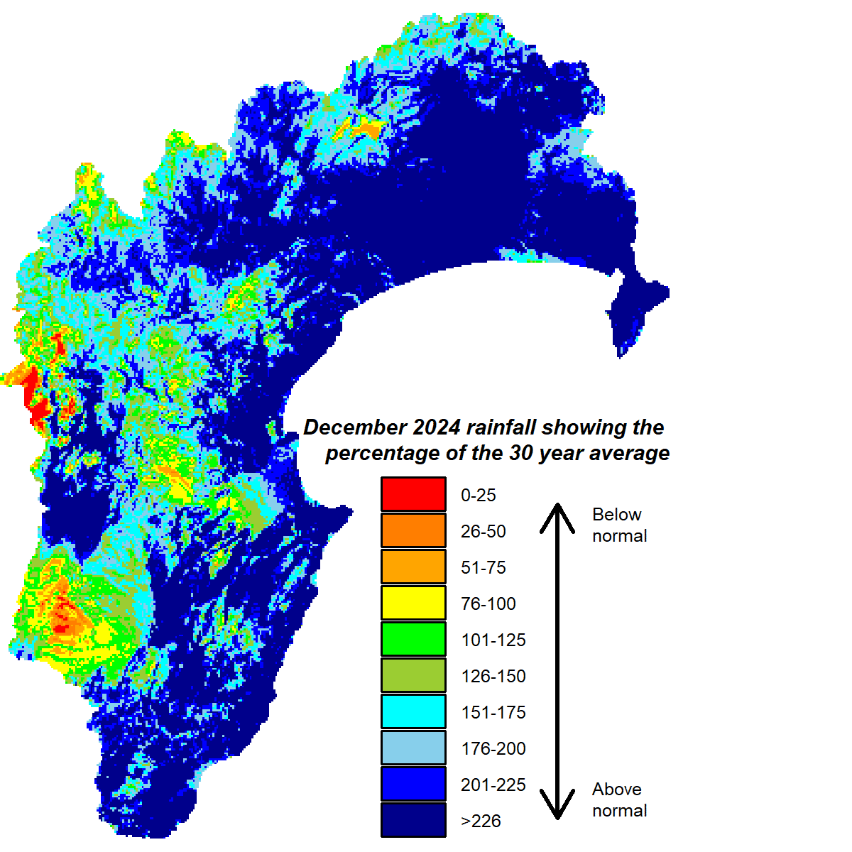
December brought the region a change in weather fortunes. The timing wasn’t great for holidaymakers, but some relief was needed from the extended dry period. It hasn’t helped that temperatures have been grim since people knocked off work for Christmas. Overall though, December’s temperatures were more than 2°C above average and rainfall was approximately 180% of the month’s long-term average. All parts of the region got the rain, with just the Kaweka Range receiving near normal rather than the above normal rainfall that fell everywhere else.
Soil moisture has returned to near or above median levels for summer. River flows have been recovering and we should know in the next month how well the rain has replenished groundwater levels.
The outlook in the three months ahead suggests further rain should come. The La Niña indices are treading a fine line with making an event official, though any event is likely to be brief. Furthermore, the sea surface temperature pattern is atypical of La Niña conditions because the cooler than average temperatures are located centrally in the equatorial Pacific Ocean rather than in the east. Sea temperatures have cooled around northern New Zealand but remain well above average in an area east of the country.
The forecasted pressure pattern has higher than normal pressure to the east and south of the country and lower than normal pressure extending across northern New Zealand, but with the chance higher pressure builds over eastern New Zealand towards the end of the three months. Winds may often have an easterly component as a result and bring us near or above normal rainfall. Modelling also suggests temperatures should improve, which would be a tonic.
All the best,
Kathleen


