
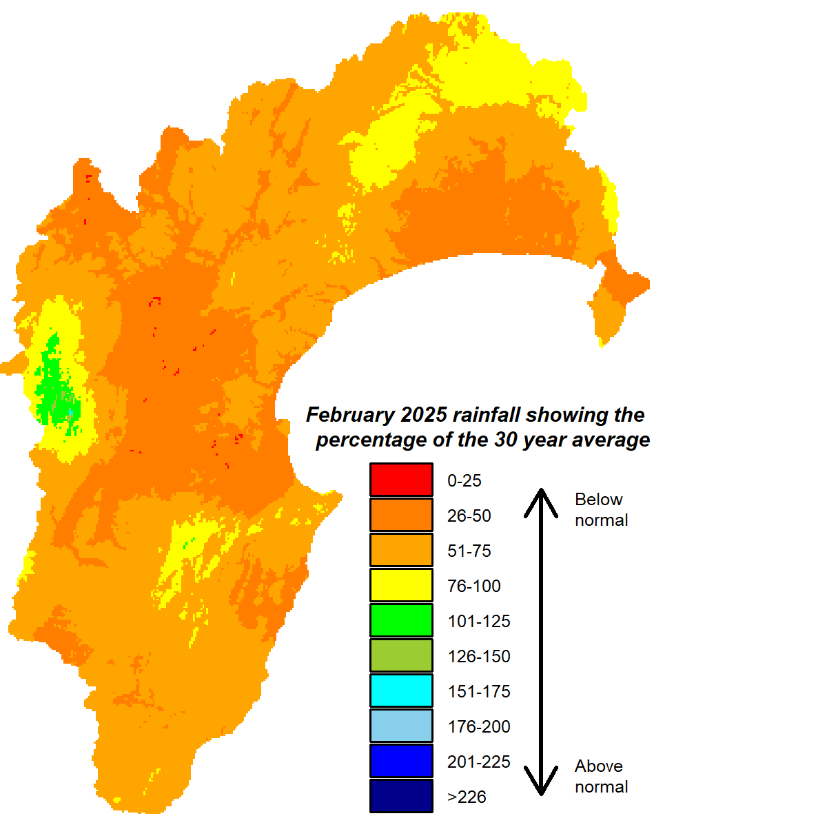
Fortunately February, being the last month of summer, actually felt like summer. Unlike January, which had an identity crisis and made like winter. February was drier than average, with the region getting only 58% of average rainfall and the Heretaunga Plains a lowly 38%. It rounded out a summer that ended up with near normal rainfall courtesy of a wet start, an average middle and a dry end.
River flows in February were below average for the time of year, while groundwater levels were near normal. Soil moisture held up well in northern parts of the region and Central Hawke’s Bay but on the Heretaunga Plains were below median levels for the end of summer. February’s daytime temperatures were near normal and pleasantly summery. Overnight temperatures were 1°C above average.
ENSO-neutral conditions are expected to dominate through this year. There are currently equal odds of neutral or La Niña conditions for next summer but it’s still a long way out. Sea surface temperatures have been higher than average around the South Island and west coast of the North Island but closer to normal off the North Island’s east coast.
Over the three months ahead, the picture looks dominated by higher than normal pressure centred east of New Zealand, which gradually weakens and possibly shifts more to the south of the country with time. Seasonal forecast models differ a bit though, which makes the outlook even more uncertain than usual. Higher pressure in the east means we’ll still often see winds from an easterly direction, potentially bringing us moisture. The strength of the highs, at least at first, could act as a barrier to lows hitting us significantly. Near normal rainfall and near to above average temperatures over the period could be the result and near to above average temperatures.
All the best,
Kathleen


