
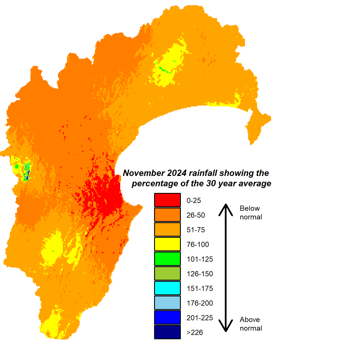
It was the driest spring the region has had for some time and rivalled the 2012-13 spring, which heralded one of the region’s worst droughts. It was the driest spring recorded at the Council’s Bridge Pa site on the Heretaunga Plains and contributed to a run of five consecutive months of below normal rainfall there. The lack of rain meant river flows, groundwater and soil moisture have all been running below average levels for the time of year. Warmer than average temperatures and, at times, windy conditions have only accelerated the drying trend.
As we run into Christmas, we’ve had some meaty showers traverse parts of the region and as I write, northern Hawke’s Bay has been doused with rain for a few days, with other areas seeing some of it. Unsettled weather continues as we make our way to the New Year. It seems we are being gifted some relief for Christmas.
Previous seasonal forecasts suggested our weather could start to turn. The pattern of higher than normal pressure extending over eastern and southern New Zealand was expected to progressively weaken and shift south, while lower than normal pressure extended eastward over the northern Tasman Sea. The current forecasts continue that theme. It gives us an easterly flow that arrives across seas that are considerably warmer than normal and enable plenty of moisture to be picked up enroute. We may not have an official La Niña but there are still hints of a La Niña influence. Summer rainfall could be near or above normal by the time the season ends and be accompanied by a good level of warmth.
All the best,
Kathleen


