Dr Kathleen Kozyniak
Principal Scientist Air
Hawke’s Bay Regional Council
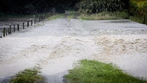
What a difference a day makes. We’re still waiting to see the full effects, but the heavy rain on the 9th November looks to have changed the region’s fortunes when it comes to the state of our water resources. Most of the rain, over 200 mm in 24 hours, was focussed on the Napier urban area and parts of the south coast, where the intensity has caused damage to properties and infrastructure. Outside those areas, totals have mainly ranged from 50-80mm over the same period. It’s been topped up with a further 30-50 mm across the region on the morning of the 11th November.
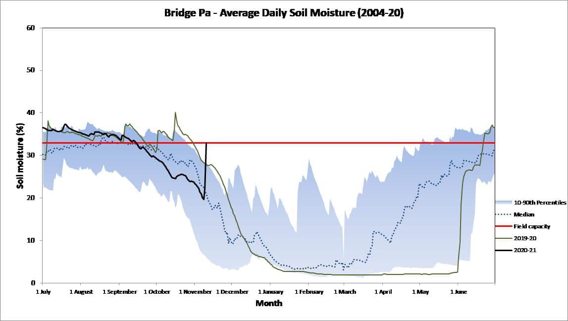
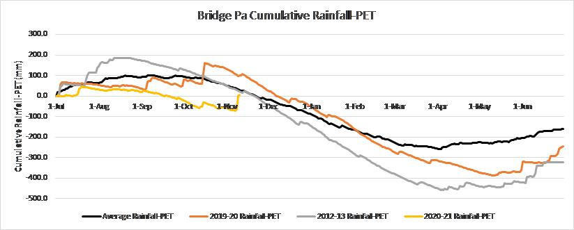
Prior to this we’ve had four months with near or below normal rainfall, soil moisture mostly near or below median levels for the time of year and both groundwater and river flows consistently below normal. Rainfall accumulation minus potential evapotranspiration (PET) so far this hydrological year (from July 2020) was significantly down on historical values. We’ve been getting by but with little in the tank if we did hit an extended dry spell.
La Niña is here and promised much – the seasonal forecast models all indicating we’d get near or above normal rainfall over November to January. So far, they’ve delivered. Not yet halfway through November, the Heretaunga Plains and the south coast have more than doubled their average November rainfall total and the only area to not yet reach its November average is the Ruahine Range (68%). Soil moisture levels have jumped to field capacity, rainfall accumulations are approaching normal levels and hopefully we’ll soon see average river flows show significant improvement and groundwater levels bolstered.


