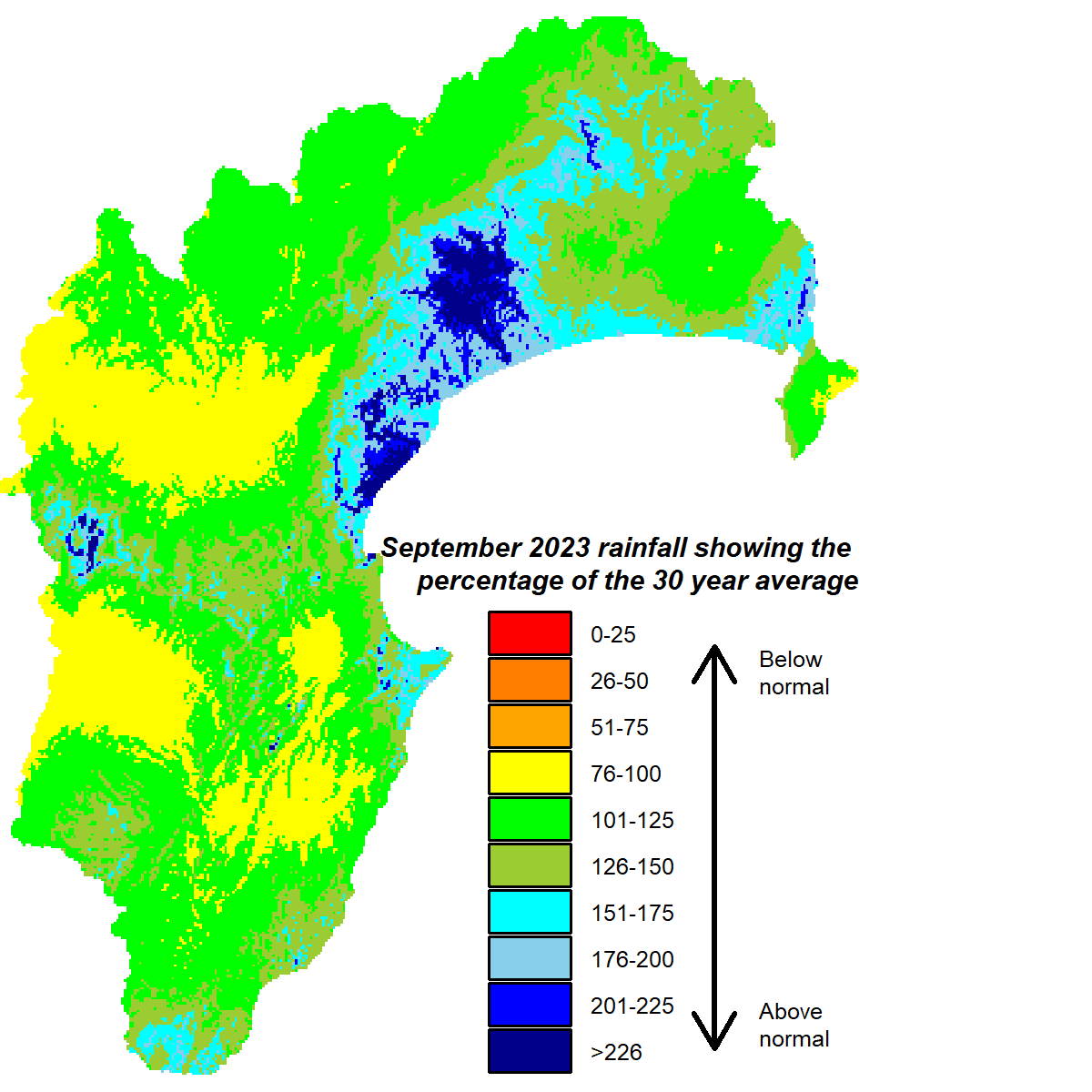
Welcome late rain curtailed what threatened to be a horribly dry September. We needed it because, up until the last week, the region had received only 5% of the average September total. Rain gauges on the Heretaunga Plains had recorded one to two millimetres at best. But within a few days most areas reached near normal rainfall for the month and even above normal in northern parts of the region and the south coast.
Soil moisture had been dropping as the month progressed, falling below median levels for the time of year in areas such as Central Hawke’s Bay. The decline was accelerated by windy and warm conditions that were 2°C hotter than average during the day. The burst of late rain pushed soil moisture into healthier territory but at the expense of river flows, which mostly languished at below normal levels for the month. Groundwater stocks were about average for early spring.
The driver of our weather over the coming months is an El Niño and a positive Indian Ocean Dipole combo. Together they elevate the risk of drier than normal weather. More frequent westerly winds are typical of El Niño conditions and that’s what we are likely to get from the predicted pressure pattern, being higher than normal pressure over northern New Zealand and lower to the south of the country. This enhanced westerly flow brings into play the rain shadow effect of our western ranges and lies behind an expectation that rainfall will be lower and temperatures higher than usual in our region over the next three months.
Percentage of Normal Rainfall

Dr Kathleen Kozyniak
Principal Scientist Air
Hawke’s Bay Regional Council


