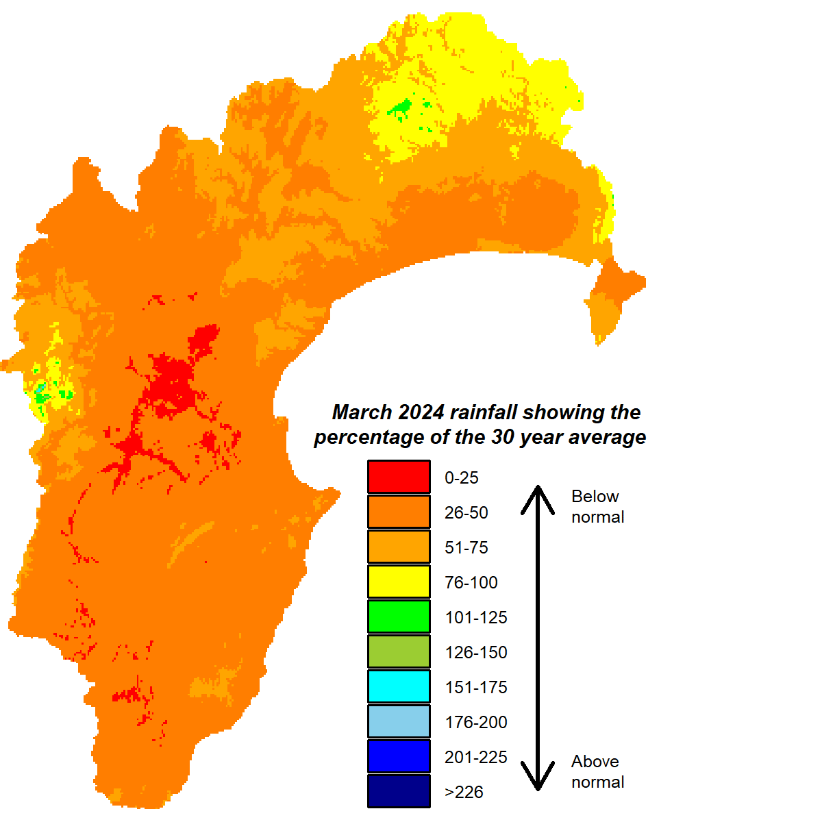
We’ve had dry run lately with two consecutive months – February and March – recording below normal rainfall and both months managing just half of their average rainfall. It looks like April could follow suit. At the time of writing, with only a week left, we’ve had 40% of April’s average.
The lack of rain has seen river flows track below normal and groundwater levels head that way too. Soil moisture has taken a dive over the past couple of months, especially sites on the Heretaunga and Ruataniwha Plains and adjacent hill country. Soil moisture at Bridge Pa has fallen into the lowest 10th percentile of readings recorded at the site for the time of year. Likewise Waipukurau and Porangahau. A month of cooler than usual temperatures seems increasingly rare, but March threw that in the mix, which at least will have stemmed the rate of moisture loss.
The El Niño event is largely over but may have a lingering effect on our weather patterns for a little while yet. A predominantly westerly flow is expected to prevail over the next few months on the back of expected higher than normal pressure across northern New Zealand and lower pressure south of the country. That, along with sea temperatures in our region lying near normal levels, makes for a forecast that isn’t full of abundant rain. The subdued sea temperatures will influence air temperatures, which could lie near normal as we flip between warm northwesterlies and brisk southwesterlies. Potential remains for La Niña conditions to emerge later in the year but it’s still early days on that call
March 2024 rainfall

Dr Kathleen Kozyniak
Principal Scientist Air
Hawke’s Bay Regional Council


