Dr Kathleen Kozyniak
Principal Scientist Air
Hawke’s Bay Regional Council
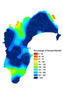
The La Niña weather pattern has been generous to a fault and I wouldn’t mind if it pared back its benevolence. We had more than double our March rainfall, on top of more than double our average February rainfall. Wairoa was hit hard by twenty days of rain in March, which saw new records being set for the month’s total at all of our sites in that area and across most of the region, even surpassing the days of Cyclone Bola. In some cases it was the wettest month in a site’s history, not just for March.
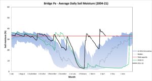
The hefty falls over the last couple of months have given us saturated soils, burgeoning river flows and groundwater levels biased towards above normal levels as we settle into autumn. The almost constantly cloudy March skies suppressed our daytime temperatures to below average levels but, along with warm sea temperatures, raised our overnight temperatures by a solid degree. Soil temperatures were similarly warmer than usual and ended the month at 20°C on the Plains and 15°C in the ranges.


The La Niña may loiter through autumn before a final farewell in winter. That leaves our weather patterns for the next three months largely unchanged. Normal or above normal rainfall is predicted, along with warmer than usual temperatures. It’s all courtesy of sea temperatures that are likely to stay warm, and a northeast air flow arising from sea level pressures that are lower than usual to the northwest of the country and higher to the southeast. As I write, the remnants of Tropical Cyclone Fili bear down on us, threatening to deliver April’s rainfall in a twenty-four hour window. We’d happily see it display some sweet dance moves and take a last minute shimmy further east.


