Dr Kathleen Kozyniak
Principal Scientist Air
Hawke’s Bay Regional Council
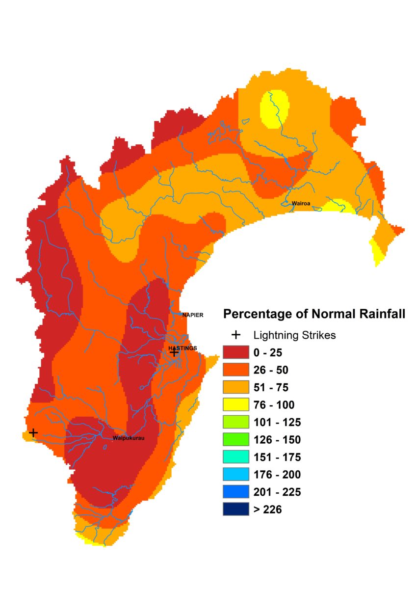
Well, after months of good rain, January decided to be contrary and barely showed up. The Plains and main ranges only got a quarter of average January rainfall and roughly 50% of normal was about the limit in other areas. Warmer than usual temperatures together with meagre rainfall can quickly turn things pear-shaped. In this case, river flows plunged and the number of water take bans at the end of January resembled the same time last year.
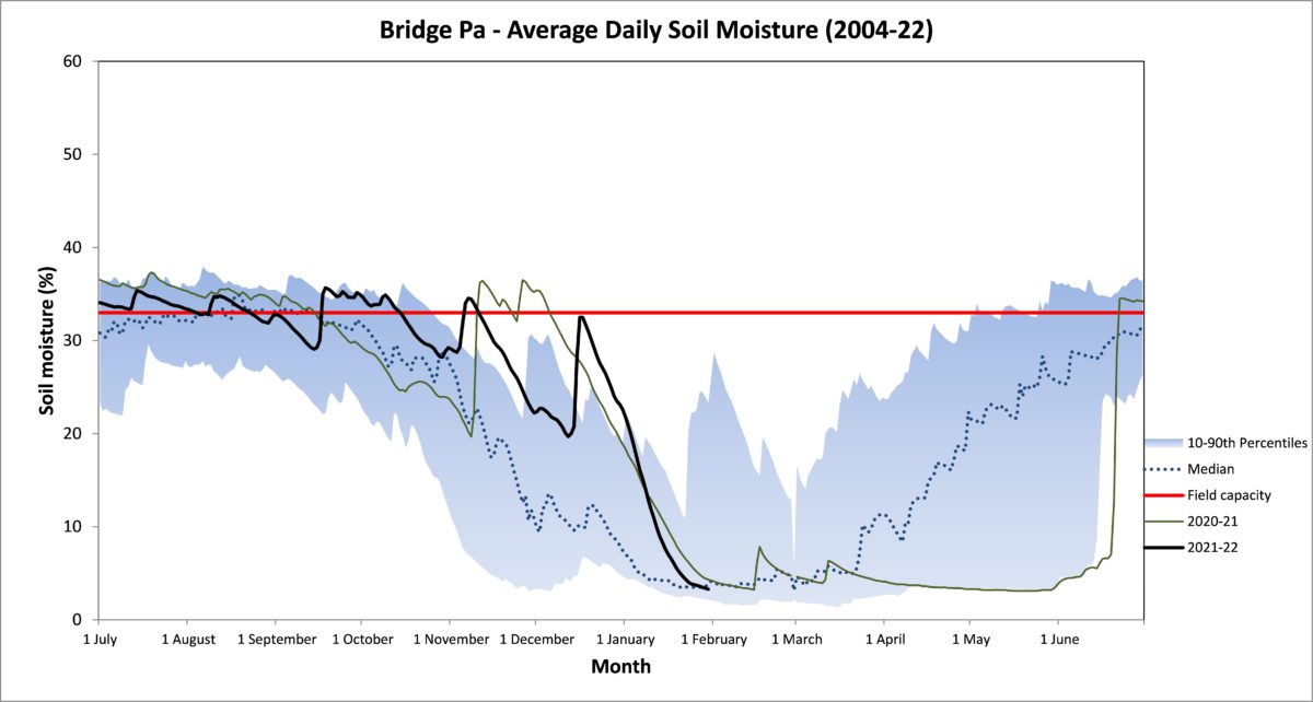
January groundwater levels looked positively rosy, with a healthy cluster in the normal and above normal band but they were measured early January, so the picture could easily change with our next check. Soil moisture has held above median levels in some areas but on the Heretaunga Plains they dropped below that mark as we tipped into February. Soil temperatures ended the month roughly average across the region – about 23°C on the Plains and 17°C in the ranges.
The forecasts for the months ahead still look promising so hopefully January is an aberration. La Niña continues, though should wane in autumn, while sea temperatures are still roasting around the country. An easterly flow seems likely, given we expect lower than usual sea level pressure to the north of New Zealand and the opposite to the south over the next three months. Normal or above normal rainfall is welcomely predicted along with warmer than usual temperatures, but preferably not to the point of being too clammy.
Percentage of Normal Rainfall