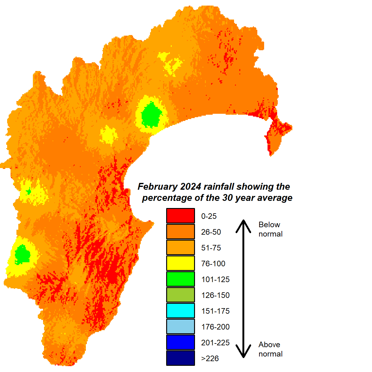
A dry February rounded out a summer that flipped flopped between wet and dry months. Only 50% of average February rainfall fell across the region but on the Heretaunga and Ruataniwha Plains it was only a third of the average. The one outlier in the region was the Ruahine Range, where rainfall was within the normal range.
Soil moisture, that had been boosted by January’s ample rainfall, dropped closer to median levels for the time of year. River flows also responded to February’s lack of rain, being near or below average whereas groundwater levels for the month were the opposite and ranged from near to above normal.
Daytime temperatures were impressive for the last month of summer, reaching more than a degree warmer than average but overnight temperatures were largely typical of late summer. Sea temperatures remained elevated in our part of the world, though cooled to more normal levels in the area immediately surrounding the country. That likely helped put the brakes on rainfall. At the time of writing (two thirds through March), we’ve had just 25% of March rainfall with little in prospect for the remainder of the month.
The El Niño is expected to weaken to neutral conditions during autumn, after which a La Niña (sigh) could develop in winter or spring. The outlook for the next three months has hallmarks of the former rather than latter, with westerlies still the expected dominant wind flow, arising from higher than normal pressure over the North Island and lower south of New Zealand. Rainfall is predicted to be near or below normal and temperatures still tracking in a warmer vein. Hopefully that equates to a balmy, pleasant lead into winter.
February 2024 rainfall

Dr Kathleen Kozyniak
Principal Scientist Air
Hawke’s Bay Regional Council


