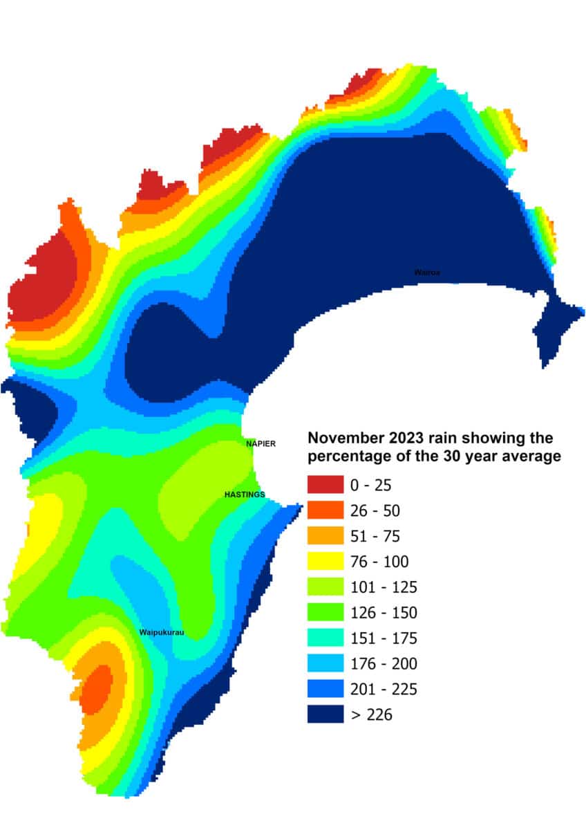
To put it simply, November was wet and gave us a wetter than usual spring overall. Northern Hawke’s Bay bore the brunt of the month’s rain, recording a whopping 400% of average November rainfall. The only area falling within the normal range was the Ruahine Range.
It has left us with ample water resources to start summer. River flows were above average for the time of year, the same goes for groundwater levels and soil moisture ended November at field capacity. Cloudiness subdued daytime temperatures, which were below average for November, but nights were almost a degree warmer than usual.
The El Niño rocks on and is expected to last out summer. No two events ever seem the same and play out differently. We got plenty of spring rain from this one, helped along by warmer than usual seas around us and western tropical waters. Not much has changed there and not much has changed in the predicted pressure pattern for the next three months. It sees higher than usual pressure extending across northern New Zealand and lower than average pressure south of the country. This still suggests a bias towards westerly winds.
A westerly flow still holds the risk of drying us out, particularly with temperatures likely to be above average. But given how things have panned out to date and warm seas have persisted, near normal rain could well result. Christmas Day is looking very warm but showery for most of our region. Regardless of the weather, here’s wishing everyone a very festive, fun day after a very tough year.
Percentage of Normal Rainfall

Dr Kathleen Kozyniak
Principal Scientist Air
Hawke’s Bay Regional Council


