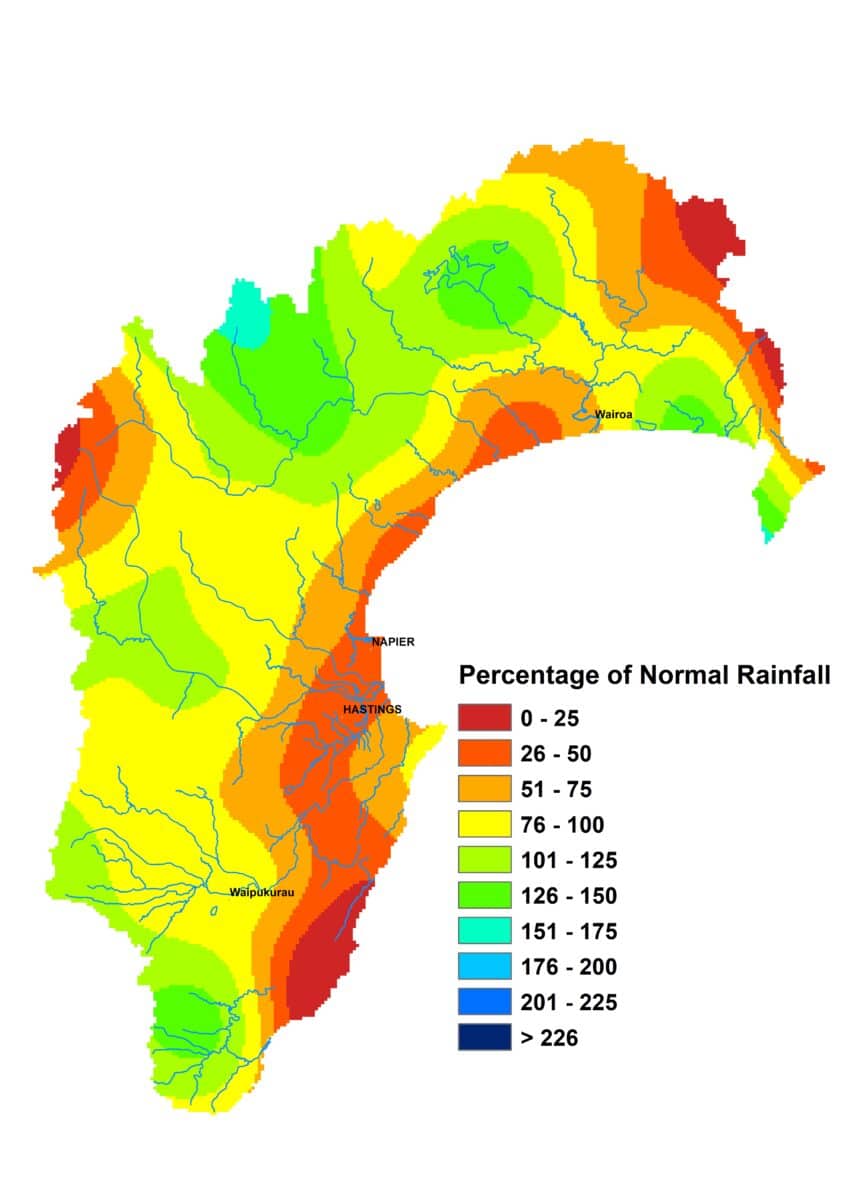
Autumn is almost over and thankfully it’s been gentle on the region so far. It gave us a reasonably dry March, then average April rainfall and a reasonably sedate start to May. It was the western ranges that saw close to average rainfall in April, while the Heretaunga Plains had about half its average and other eastern areas, such as Wairoa and the south coast, were nearer to 75%.
With April’s rain falling mainly in the ranges and into the headwaters of our rivers, flows were higher than usual for the month. Soil moisture didn’t dive downwards despite the drier weather and stayed above median levels for the time of year and still at field capacity in many areas. April’s air temperatures were warm for mid-autumn, especially the overnight temperatures, which were more than 2°C above average. No surprises then that soil temperatures were warmer than usual in April, but at the time of writing were close to the mid-May average of about 11°C.
It seems likely that El Niño conditions will develop during winter and remain with us for summer. We’re also likely to see a positive Indian Ocean Dipole by the end of winter too. Together they suggest drier than usual weather as we move further into the year. The prospect for winter appears to be one of higher than normal sea level pressure to the northwest of the country and lower to the east, signalling a move towards a westerly wind flow. Winter temperatures are expected to be near or above normal and rainfall near or below normal. Below normal rain could well become the mantra to replace the past year’s “above normal” running theme.
.
Percentage of Normal Rainfall


Dr Kathleen Kozyniak
Principal Scientist Air
Hawke’s Bay Regional Council


