
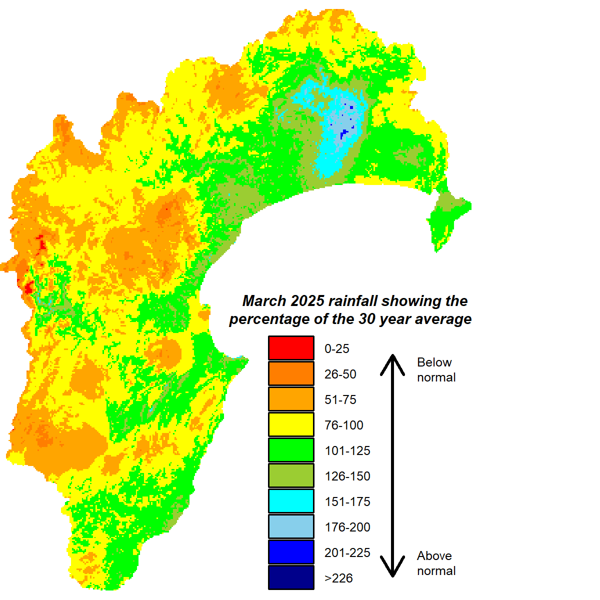
Our March rainfall snuck into the “near normal” category, although it wasn’t evenly distributed across the region. Northern Hawke’s Bay saw the bulk of it, getting 140% of the month’s long-term average, while most areas received approximately two thirds of their March average. No wonder then that soil moisture in the north has been looking mostly okay but the likes of Bridge Pa, on the Heretaunga Plains, Te Haroto and Porangahau have been running at or near wilting point. March river flows were below normal and ground water levels were dipping into below normal status too. Daytime temperatures were about 0.5°C warmer than average but overnight temperatures were close to the March average.
Ex-tropical cyclone Tam is influencing New Zealand’s weather as I write. Parts of the region could definitely do with some rain and at this stage it looks like we may get helpful rather than worrying amounts. Hopefully, that remains the case. The La Niña is history and we are in neutral conditions, although a bias to easterly flows is still likely. This is due to seasonal forecast models favouring higher than normal pressure centred southeast of the country and lower than normal pressure to the northwest of New Zealand. Sea temperatures around us are warmer than average and expected to largely remain that way.
Easterlies plus warm seas suggest rain might be forthcoming for our region, but they will be battling high pressure systems that have been reasonably effective in steering bad weather away. We’ll soon know whether Cyclone Tam made inroads, otherwise the forecast for the next three months reflects a balance in the battle, giving us near normal rainfall and near or above average temperatures.
All the best,
Kathleen


